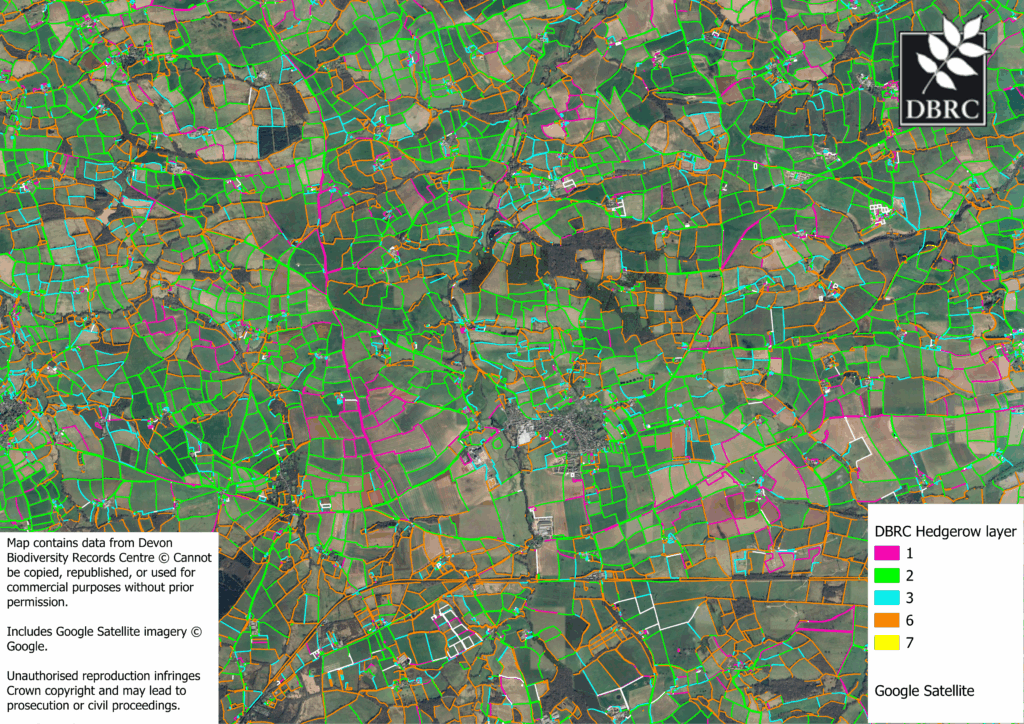
DBRC Linear Features Layer
In response to various project needs, DBRC has produced a linear features layer, that maps likely hedgerows and their height. This layer was modelled using OS Mastermap data and Lidar canopy height models to provide an estimated height and length of a hedgerow. This is split into the average height of the hedge along a set line, as well as the highest and lowest points along that line. Height data has been simplified into 6 “bins” for ease of reading.
The data is provided in a GIS format along with a schema covering the caveats and production of the dataset. We are continually working to groundtruth and improve the accuracy of this layer as part of our field survey programme.
This data can be used for modelling or for for desk study surveys of an area. Please note that there is a natural delay between the capture and publication of Lidar data. As a result some hedge heights may be inaccurate depending on the management of the hedge. If you would like to request a sample of the data to see if it suitable for your project, please contact ccalvert@devonwildlifetrust.org to discuss your project and its needs.
If your project requires more up to date information on a site, you may be interested in our habitat or drone surveying services. Linear features data can be be accessed for £7.50 per km2 of data required plus an additional £55 administration fee. For searches of 20km2 or larger, please contact mwindle@devonwildlifetrust.org for a custom quote.