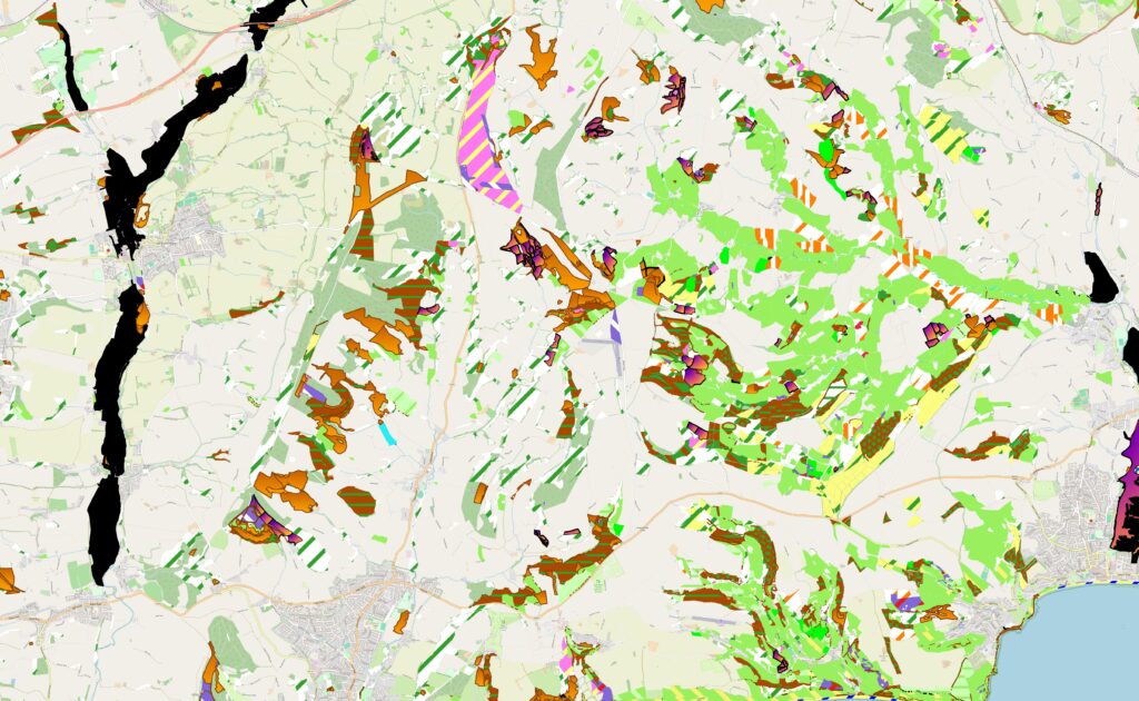
Combined Habitat Layer
Over the last 30 years, DBRC has generated significant quantities of habitat data through its many projects and initiatives. From high quality ground-truthed data from our survey team, to extensive broad habitat data captured through aerial photo interpretation, within targeted areas of the county.
Whilst traditionally there has been a focus on Priority Habitats within our outputs, there are other significant habitats and land uses, which are important for species, and a functioning landscape. To ensure that all of the habitat data DBRC holds, can have maximum impact for Natures Recovery, We have spent the last three years working on a method to rank and combine these various datasets. The aim, to produce a map of all the habitat data we hold in Devon – our Combined Habitat Layer. This layer has then been combined with openly available external datasets such as Natural England’s Priority Habitat layer, to produce maximum coverage of the Devon landscape.
The combined habitat layer contains land use data in the form of UKHab primary and secondary codes, as well as confidence data based on the age of the data and methodology used to create it. This will be continually updated with the novel data generated by DBRC’s extensive field survey programme. Any relevant new data from other sources such as the Priority Habitat Inventory will also be kept up-to-date. In this way, the Combined Habitat Layer will provide the most up to date available data at any one time.
This dataset will soon be incorporated into our existing data search product as part of the habitat search data suite, as well as being available as a stand-alone product. The Combined Habitat Layer can be accessed for £7.50 per km2 of data required plus an additional £55 administration fee. For searches of 20km2 or larger, please contact ccalvert@devonwildlifetrust.org for a custom quote.